Welcome to our premier drone services page, where innovation takes flight!
 At OrbitSystems, we take immense pride in offering cutting-edge solutions that redefine how you perceive the world from above. Our expertise encompasses two remarkable offerings: photogrammetry and aerial photography.
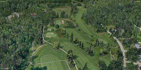
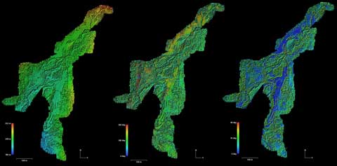
With our state-of-the-art photogrammetry services, we harness the power of advanced drone technology to transform images into intricate 2D/3D models. Our skilled pilots and specialized equipment capture multiple images from varying angles, and through meticulous analysis, we weave these images into accurate and detailed three-dimensional renderings. Whether it's for architectural planning, land surveying, or environmental analysis, our photogrammetry services provide unparalleled precision, allowing you to visualize and measure spaces like never before.
Equally captivating is our aerial photography service. We soar to new heights to capture moments from a perspective that's both breathtaking and impactful. Our adept drone pilots have an eye for detail and a knack for composition, ensuring that each photograph narrates a unique story. From sprawling landscapes to architectural marvels, our aerial photographs transcend the ordinary, making them perfect for marketing materials, real estate showcases, or simply preserving awe-inspiring moments in their full grandeur.
At Orbit Systems, excellence is our compass. Our drone services are not just about technology; they're about the artistry of capturing the essence of a space or moment. With an unwavering commitment to quality, precision, and creativity, we invite you to explore the world anew through our lens, where every angle tells a story and every detail comes to life. Discover limitless possibilities with our photogrammetry and aerial photography services – where innovation meets elevation.
Embark on a Journey of Precision and Depth with our Remarkable Photogrammetry Services!
Immerse yourself in the world of innovation with our state-of-the-art photogrammetry services. At Orbit Systems, we seamlessly merge the cutting-edge capabilities of advanced drone technology with our expertise to transform images into meticulously detailed 2D and 3D models. With a team of skilled drone pilots and specialized equipment, we expertly capture a multitude of images from diverse angles. Through a process of meticulous analysis and intricate craftsmanship, we then intricately weave these individual images into comprehensive and highly accurate three-dimensional renderings.
 From architectural marvels that require precise planning to expansive landscapes that beckon for environmental analysis, our photogrammetry services are the epitome of precision and sophistication.
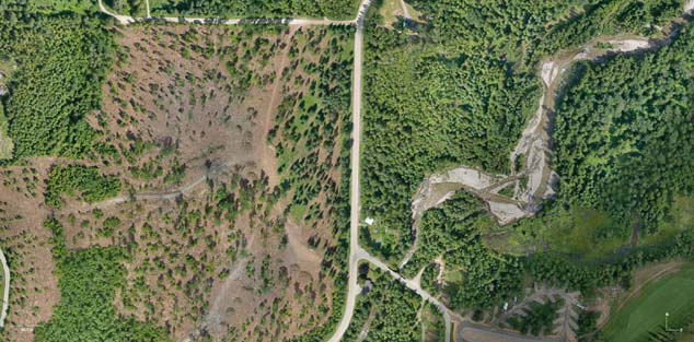
It doesn't stop there – we take it a step further by creating orthomosaic maps that provide a seamless blend of aerial imagery, resulting in ultra-high-resolution composite maps. These orthomosaics offer an unparalleled view of your project area, making them invaluable for industries ranging from construction to agriculture. Contact Us today, to get a quote for your project.
Unlock a new dimension of visualization and measurement with Orbit Systems. Embark on a groundbreaking journey into a realm of unparalleled visualization and measurement with Orbit Systems. Our cutting-edge photogrammetry services are at the forefront of technological advancement, revolutionizing precision in ways previously unimaginable.
Step into a new era where the ordinary transforms into the extraordinary, as our orthomosaic maps unveil a level of detail that transcends conventional boundaries. Precision is not just a goal; it's a standard redefined by Orbit Systems.
Our innovative technology acts as a brushstroke on a canvas, seamlessly blending accuracy with artistry. With us, exploration takes on a whole new meaning. Navigate and delve into your spaces like never before, as our transformative solutions unlock dimensions that were once beyond reach.
Orbit Systems is not just a provider of services; we are architects of an immersive experience where every pixel tells a story, and every measurement is a testament to our commitment to excellence. Join us in exploring a world where technology meets imagination, and where the fusion of accuracy and artistry paints a picture of limitless possibilities. Orbit Systems - where visualization meets innovation.

